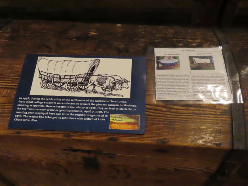
On April 7, 1788, an unusual river craft, the “Adventure Galley” coasted through the early morning mist and landed at a point slightly below the confluence of the Muskingum and Ohio Rivers. Due to the foggy conditions and the huge sycamore trees that obscured the mouth of the Muskingum, the party had inadvertently passed their intended debarkation point (the present site of Marietta) and landed below Fort Harmar. With the aid of the garrison from the fort, the flotilla was towed back up to the Muskingum, making possible the second historic landing of the day. The landing culminated the one-thousand mile journey of a vanguard of forty-eight hardy pioneers. The party, led by General Rufus Putnam, had trekked from Massachusetts in the depth of winter to establish Ohio’s first city, Marietta.
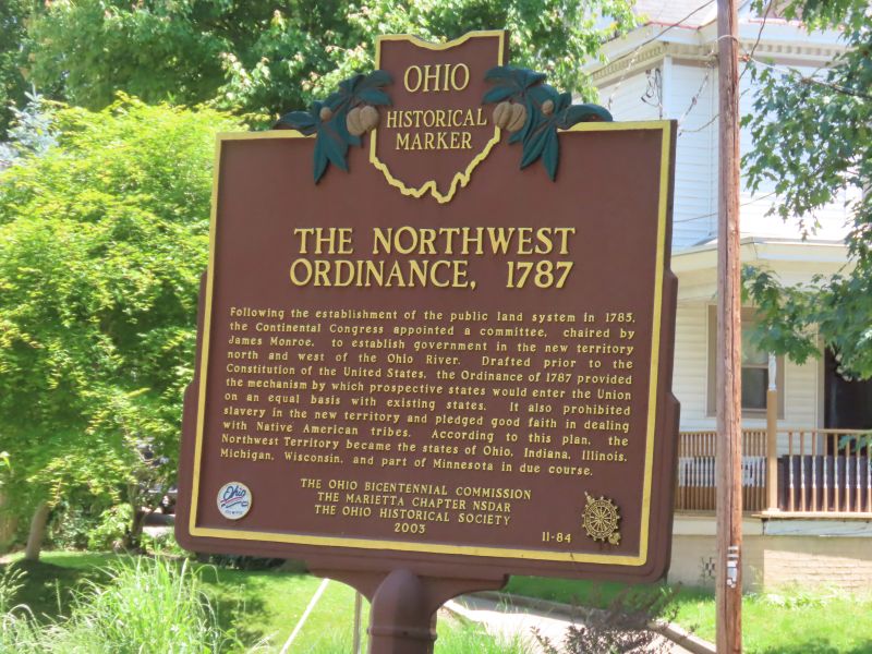
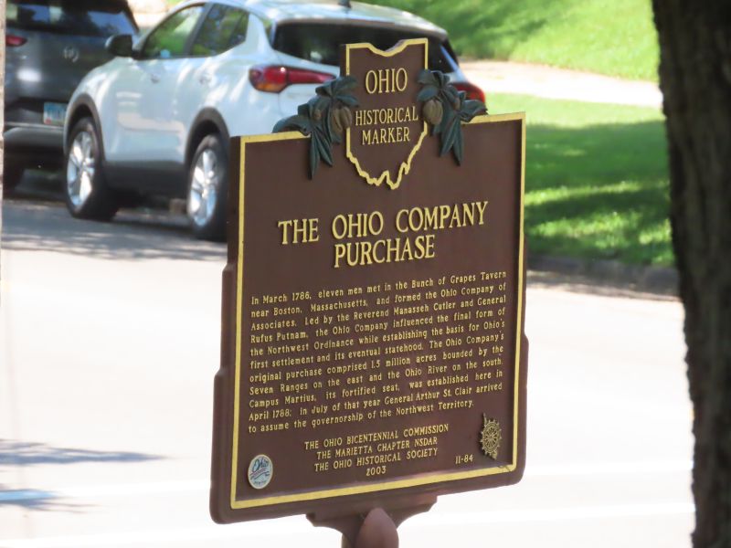
The seeds of settlement of the Ohio Country had been sown two years earlier when Gen. Rufus Putnam and Dr. Manasseh Cutler spearheaded a meeting of parties interested in a westward migration. This historic gathering took place March 1, 1786 at the Bunch of Grapes Tavern in Boston. The Ordinance of 1787 opened for settlement the new territories west and north of the Ohio River.
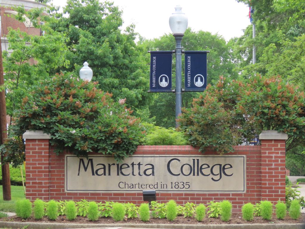
Marietta, Ohio was founded in 1788, the first settlement in the Northwest Territory. It wasn’t Ohio’s first settlement- Martin’s Ferry has that honor- but it was Ohio’s first permanent settlement and city, the gateway to the expansion of the original US colonies, created after the American Revolution and the independence of the United States of America. The Ohio River had been the border of the nation, now the lands to the northwest of this mighty river were open to settlement and expansion- which the Native Americans already there resisted.
The early United States was cash-poor but land-rich. It paid veterans of the American Revolution in land. Surveying and settling the land was an attraction to many- a young Geroge Washington was a surveyor. The Northwest Territory was the beginning of the great westward expansion of the country.
Incidentally, Marietta takes its name from Marie Antoinette, the French queen. This was to honor France’s support of the American colonies during the American Revolution.
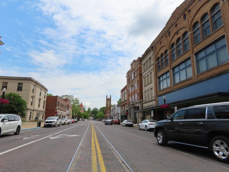
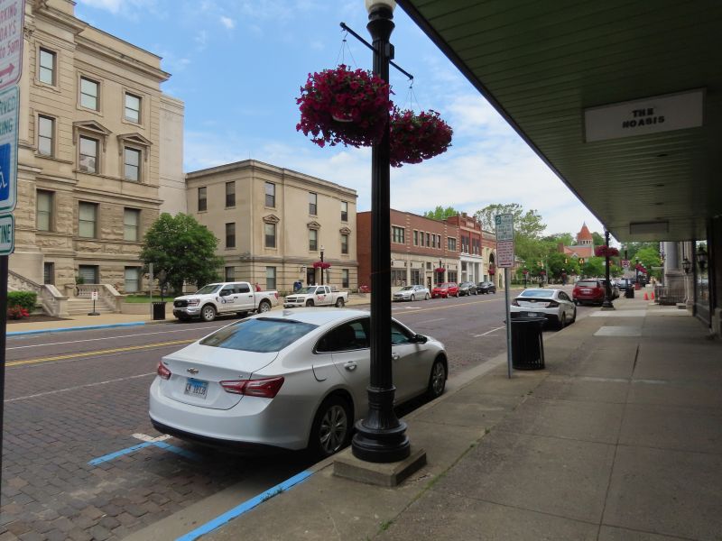
In May of this year a friend and I traveled to Marietta to see some of its history. The weather was quite hot, but the trip was enjoyable.
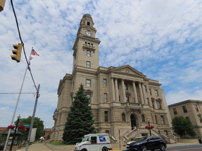
Here is the Washington County courthouse in downtown Marietta. Built in 1901, it contains memorials to local veterans as well as marble facings and a mural depicting Jurassic Period life. I have a fondness for Ohio courthouses, their architecture and history.
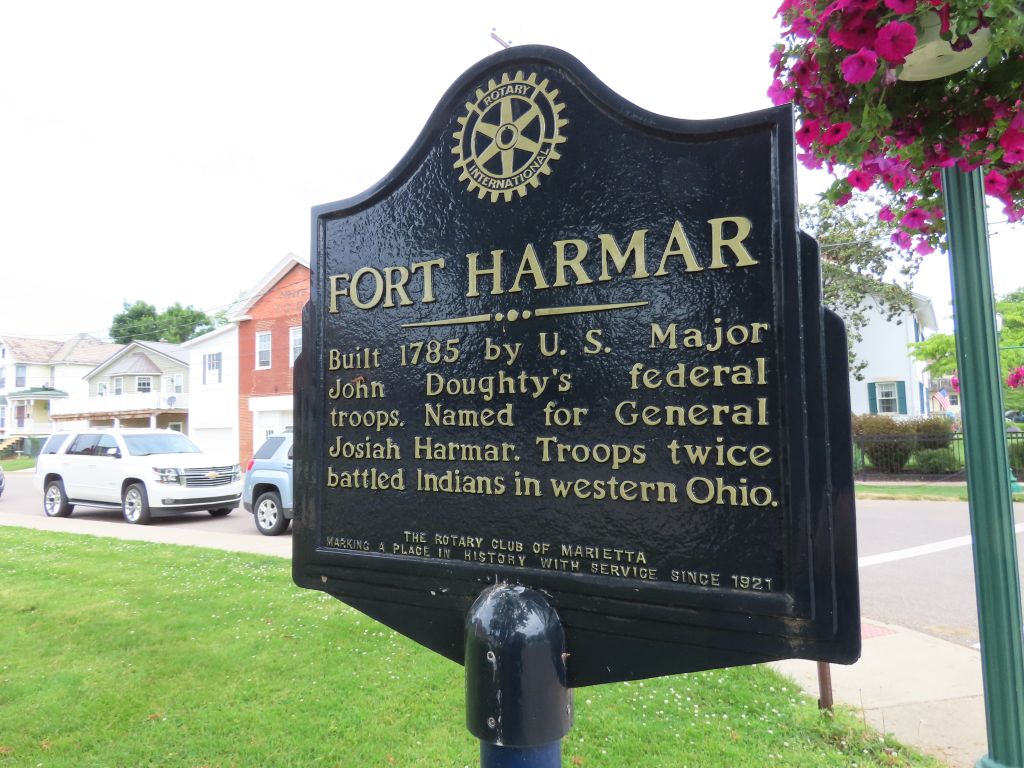
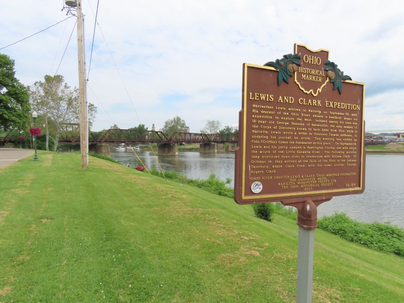
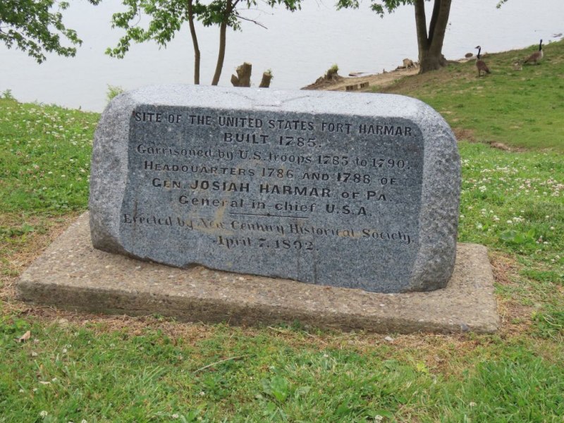
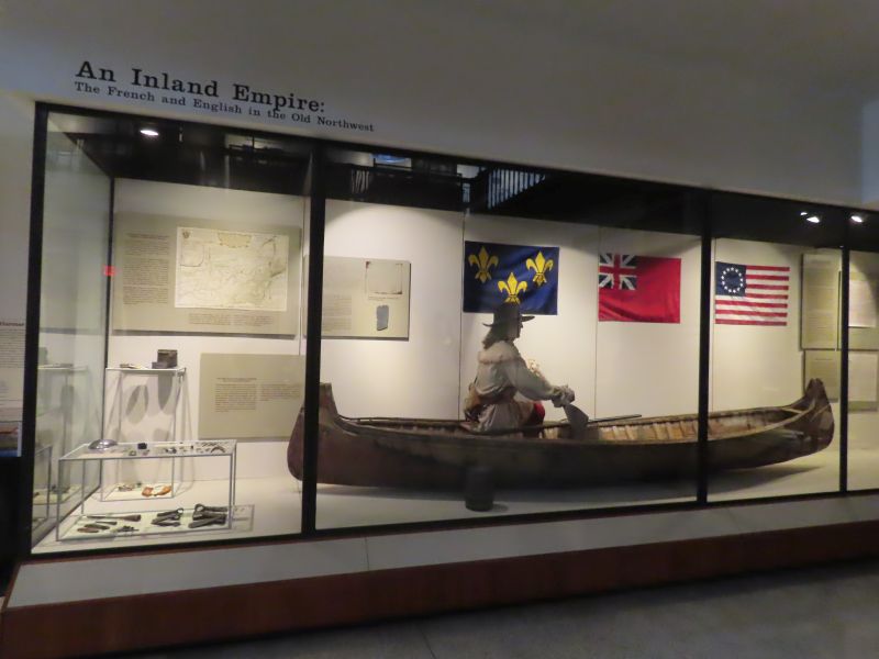
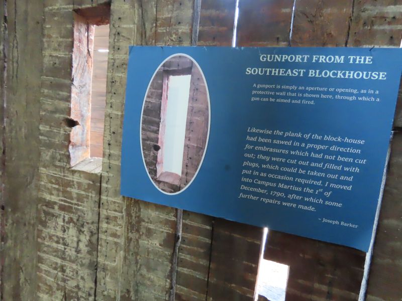
Fort Harmar was built a few years before Marietta at the confluence of the Ohio and Muskingum Rivers. Its original purpose was to protect Native American lands in Ohio from illegal settlers. Before the Northwest Ordinance squatters were known to occupy land northwest of the Ohio River. The fort later became an anchor for American troops participating in the early stages of the Northwest Indian War. Troops from the fort marched to fight in Harmar’s Campaign, culminating in Harmar’s Defeat. The Lewis and Clark Expedition had its beginning here in 1806.
The current location of the fort is underwater- the Muskingum River has changed its course over the centuries as rivers are wont to do.
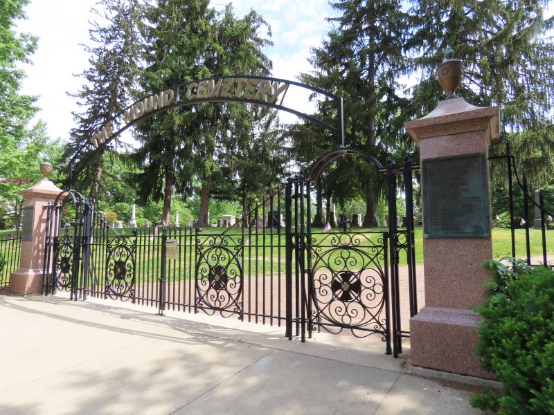
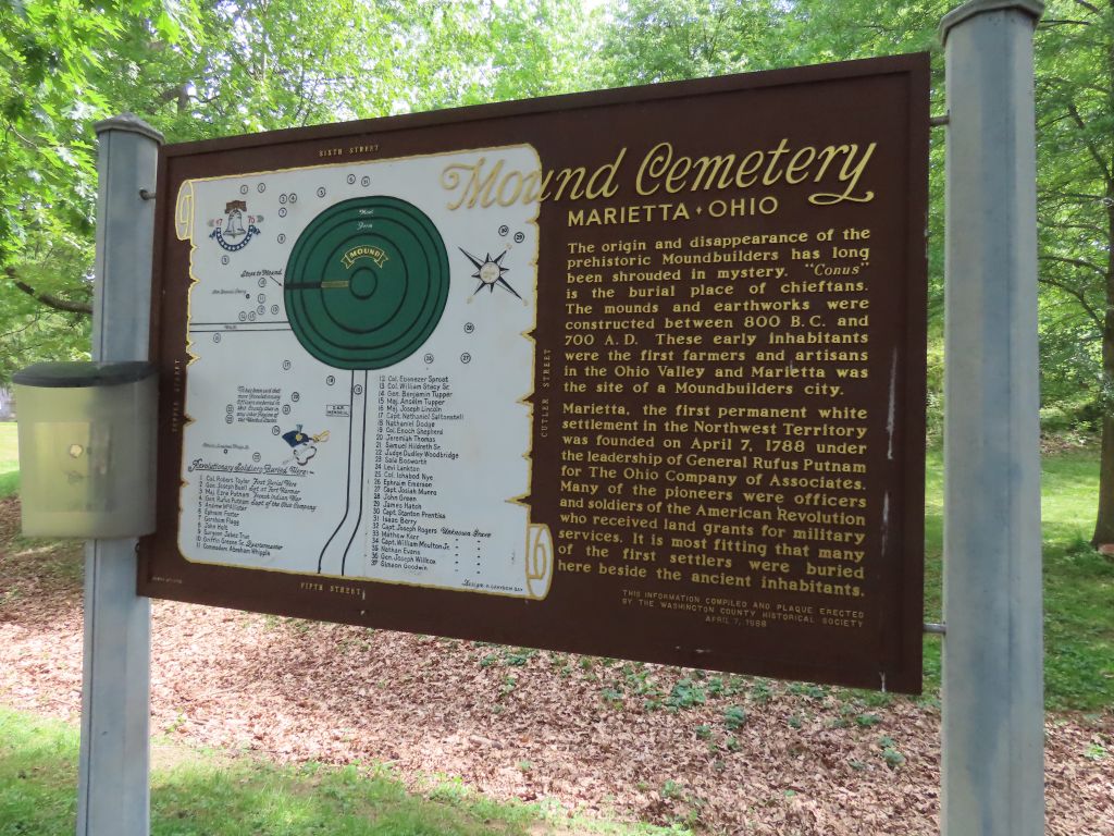
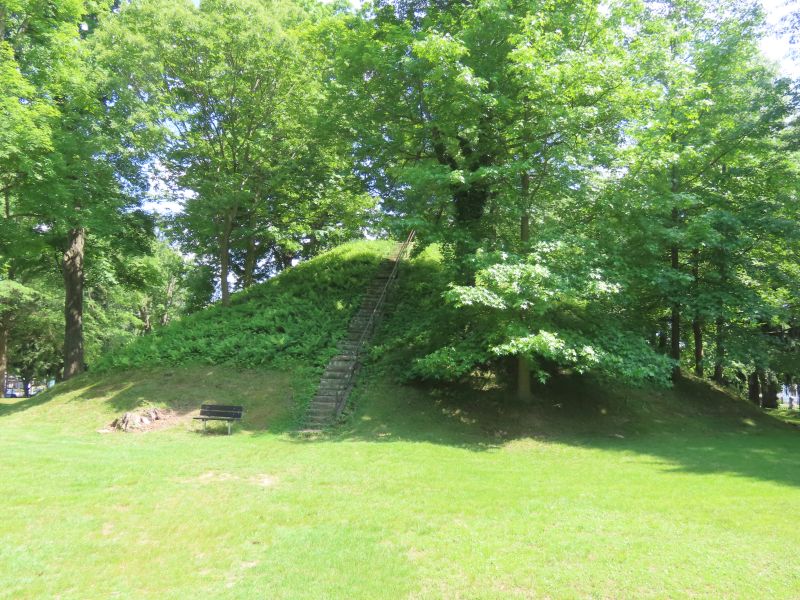
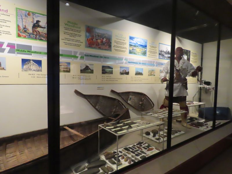
Mound Cemetery takes its name from the prominent Conus Mound whose construction was in the earlier Adena period.
Fortunately Marietta, unlike many other midwestern communities, still retains some of its prehistoric earthworks. This is due to the foresight of the Ohio Company of Associates who in 1788 named the mounds and decided to preserve large parts of these earthworks in public parks. The members of the Ohio Company actually undertook an effort at dendrochronology and harvested a tree from the top of the mounds. They counted at least 400 years of growth on that tree.
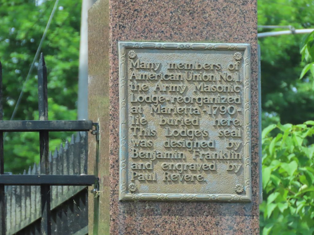
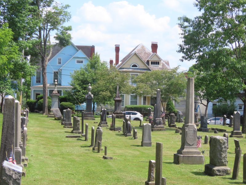
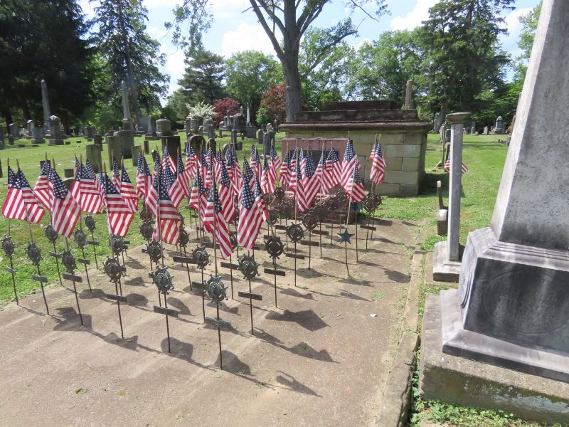
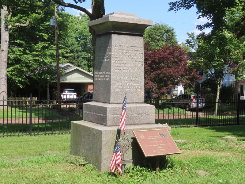
There are many graves of historical figures in Mound Cemetery, including General Rufus Putnam, the founder of Marietta. He led the personnel and settlers of the Ohio Company of Associates to found the town in 1788.
Many other American Revolution veterans are buried here.
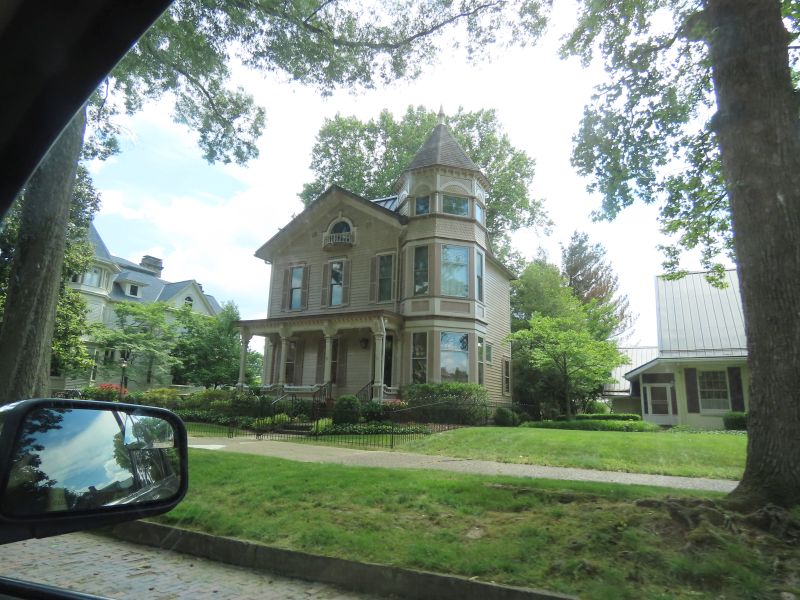
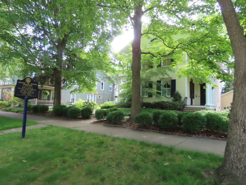
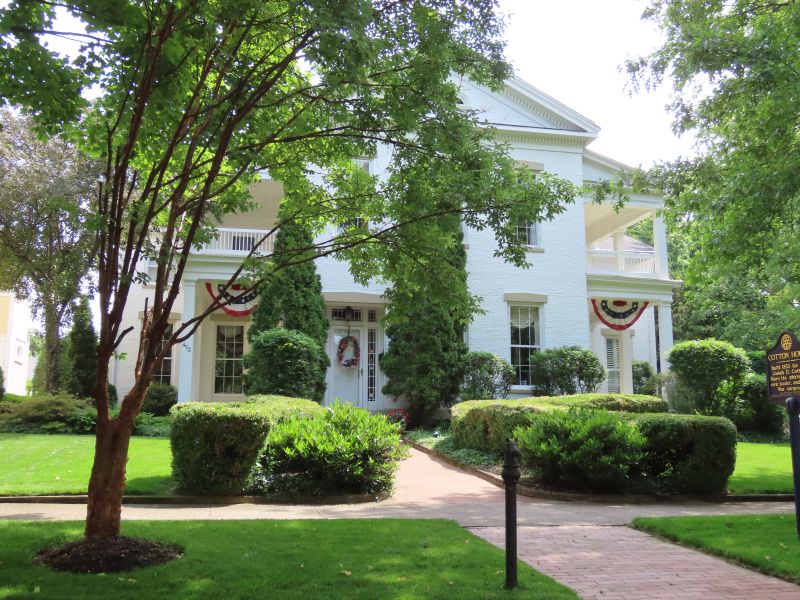
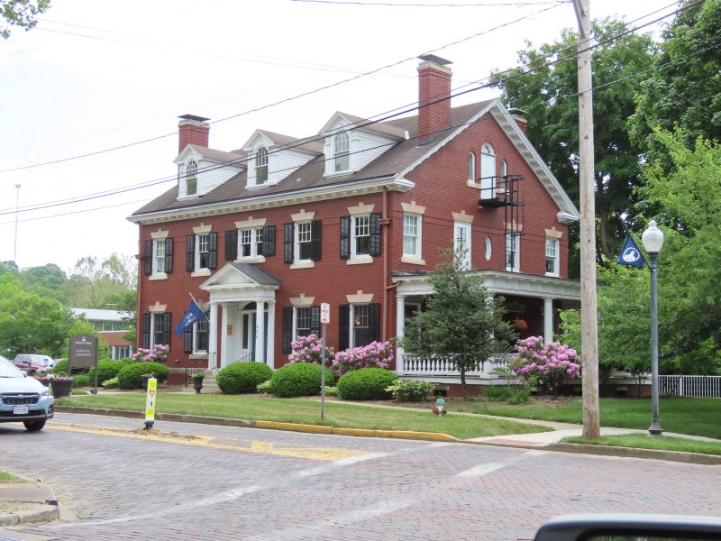
There are many houses of historical interest in Marietta. Quite a few have historical markers out front.
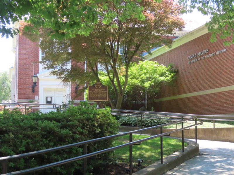
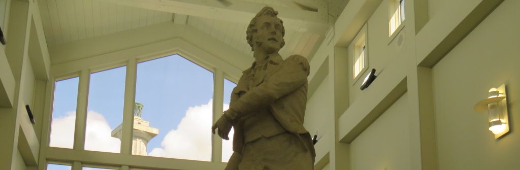
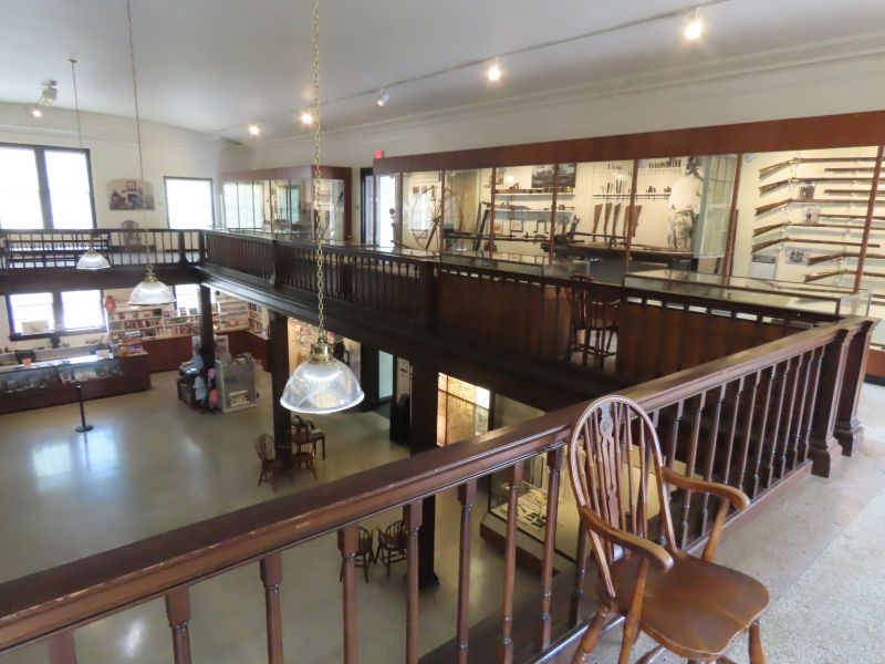
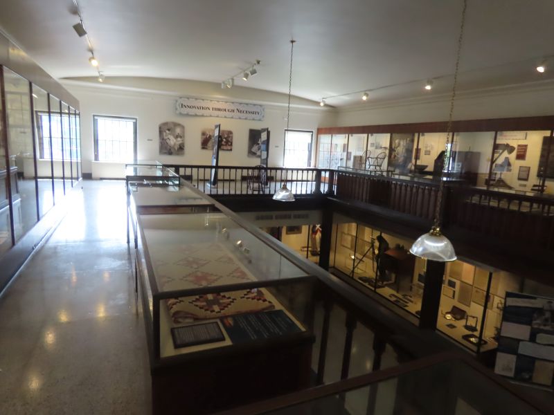
The Campus Martius Museum of the Northwest Territory is a must-see experience for history buffs.
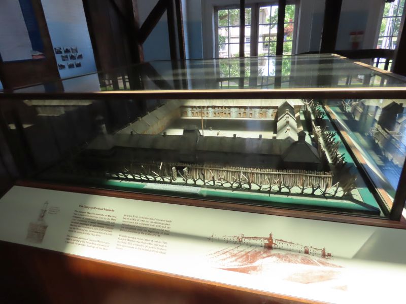
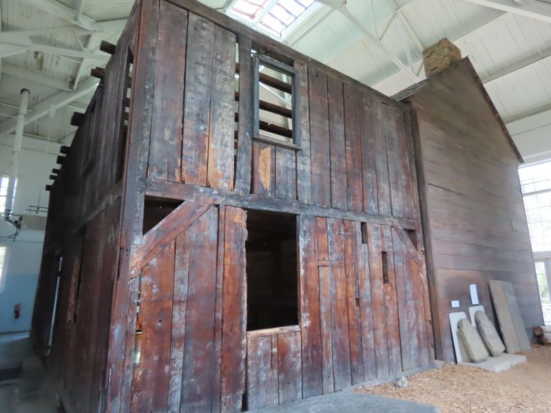
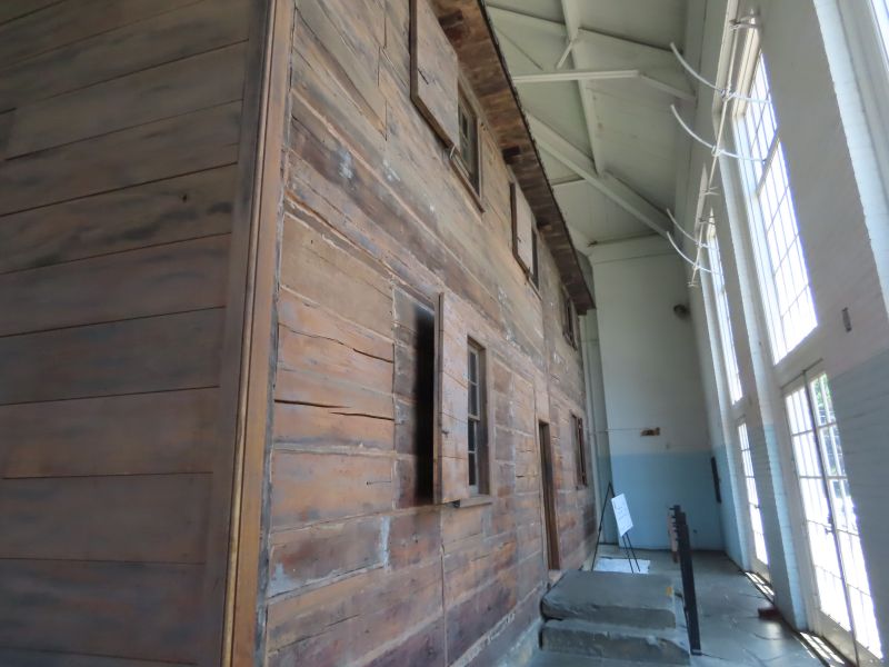
Campus Martius Museum was built on the site of the original stockade, built by the Ohio Company between 1788 and 1791. The name, Campus Martius, chosen by the Ohio Company, comes from Latin for Field of Mars, the military camp where the legions of ancient Rome once trained. Known by the early settlers as the stockade or Campus Martius, the original fortification was built to house and protect the members of the Ohio Company during the Ohio Indian Wars of 1790 to 1794. By 1795, after the signing of the Treaty of Greeneville, the stockade was no longer necessary. Buildings were then dismantled, the wood planks used in the construction of some of the homes located throughout Marietta.
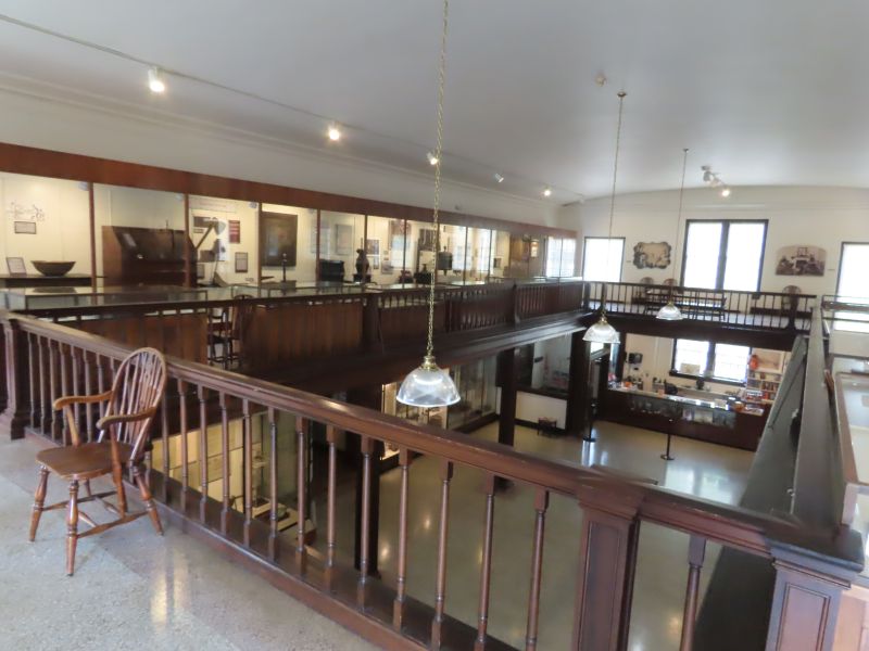
I’ve visited a good amount of Ohio museums, and this one is one of my favorites.
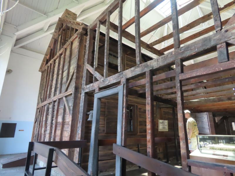
One of the highlights of the museum is the house of Rufus Putnam, founder of the Marietta settlement. Originally part of the Campus Martius stockade, it because a stand-alone house when the defensive walls were no longer needed. The museum was built upon the site of the original stockade. The house was renovated 50 years ago by the Ohio Historical Society.
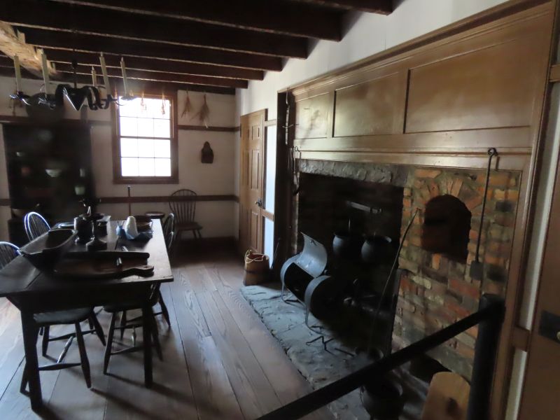
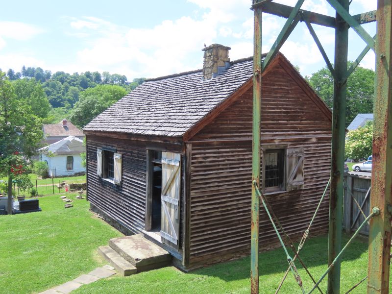
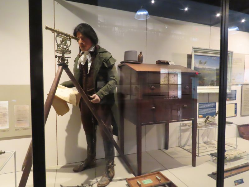
The museum is also the present site of the Ohio Company Land Office, which was moved there in 1953 to insure its future preservation. In this office, land deeds were allotted for the original Ohio Company Purchase. Here, Rufus Putnam, the first surveyor- general of the United States, made some of the earliest maps of the Northwest Territory.
The land office, a simple log house originally with one window and a chimney, is the oldest remaining building in Ohio. It was built in 1788.
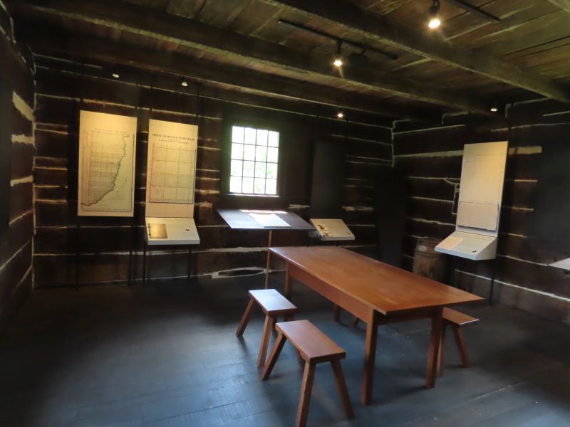
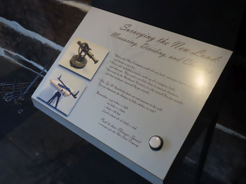
Company surveyors plotted out the 900,000 acres that the Ohio Company owned from this building. Ohio is divided into townships, squares 6 miles on a side, divided into 32 subsections of 1 square mile each (640 acres). Eventually 3/4 of the United States was surveyed and laid out in this way. One subsection near the center of the township was devoted to a school and funding the school. So, you only had to walk a maximum of 3 miles to school back in the day! (personal note: I walked a mile or two to school, because I enjoyed the walk).
Surveying the Ohio wilderness at the time was difficult and could be dangerous. There was a lot of money resulting in such efforts. There were many legal cases and arguments about who owned what in the early days; there was outright fraud (the founding of Gallipolis is an example). Frontiersmen like Daniel Boone and Simon Kenton claimed thousands of acres- blazing their tomahawk marks upon trees- but ended up with very little (if any) land after the courts got done with them. Daniel Boone kept moving west all of his life.
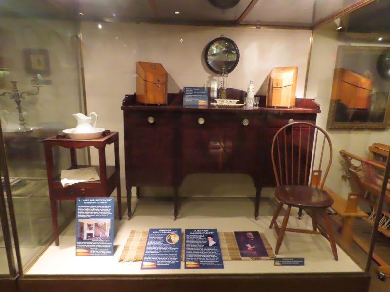
There are pieces of furniture on display from the mansion on Blennerhassett Island in the Ohio River, not far from Marietta. Hopefully this will be a subject for a future blog post.
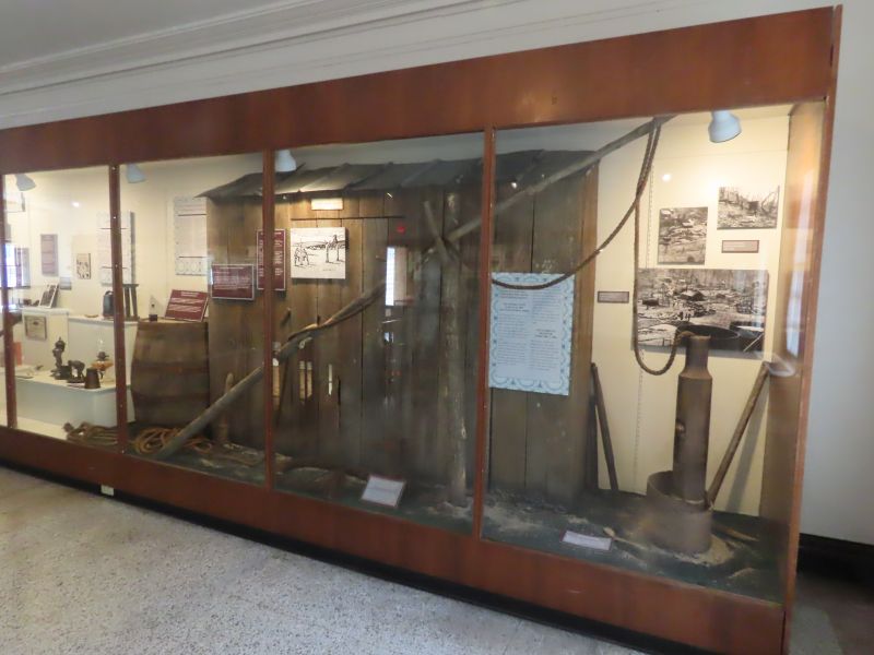
A primitive oil pump.
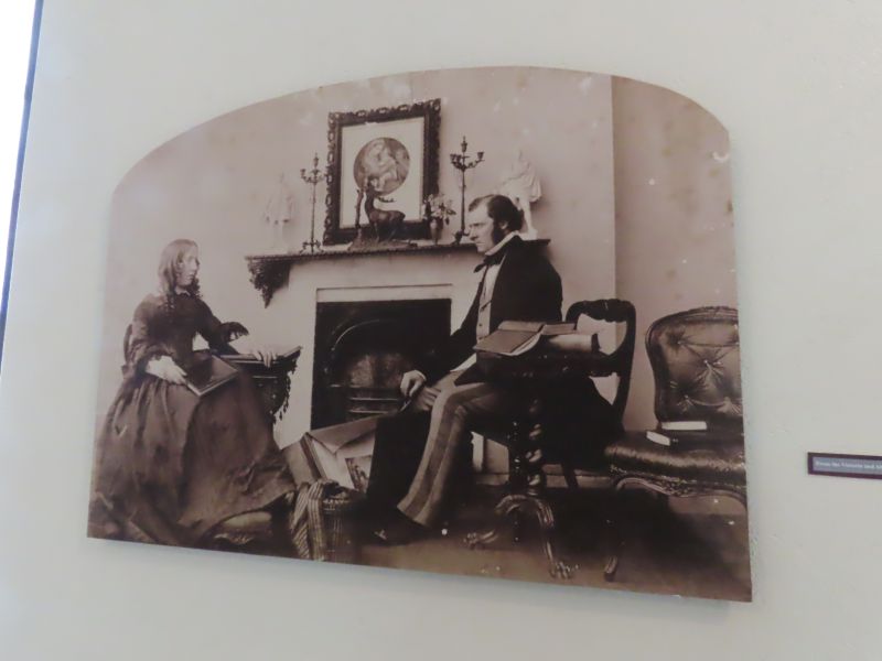
A daguerreotype, an early type of photograph.

We enjoyed our trip to Marietta, where the western migration across the United States began.
Interesting reading on some of the topics covered here:
The Old Northwest Territory: America’s First Great Westward Expansion by the Norfolk Towne Assembly.
